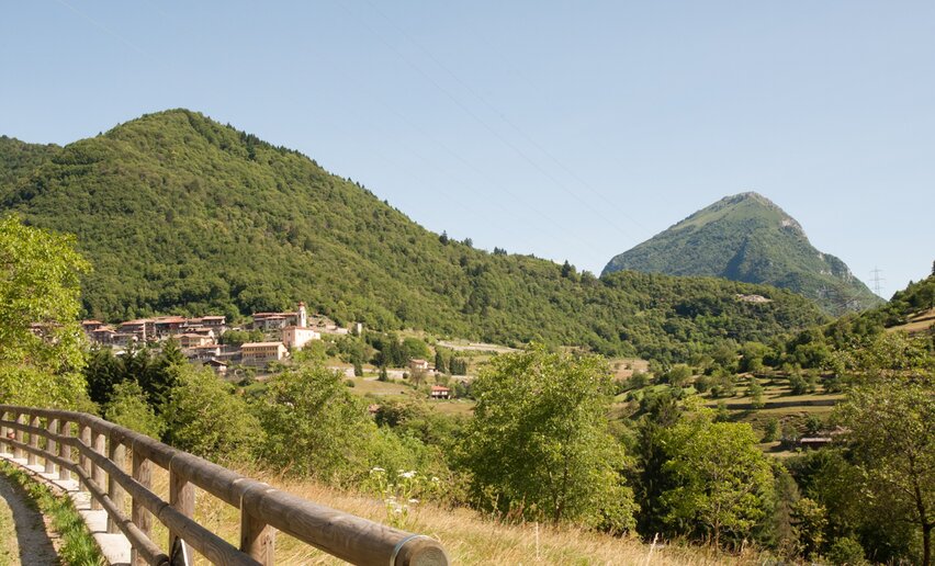
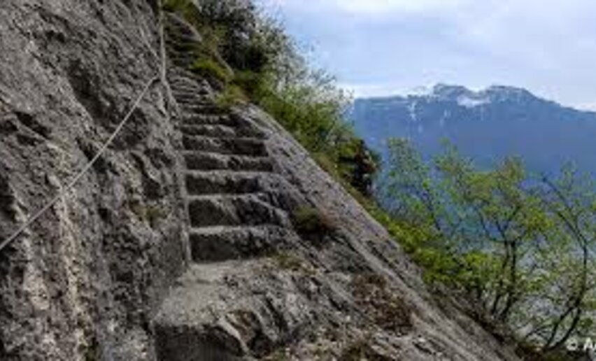
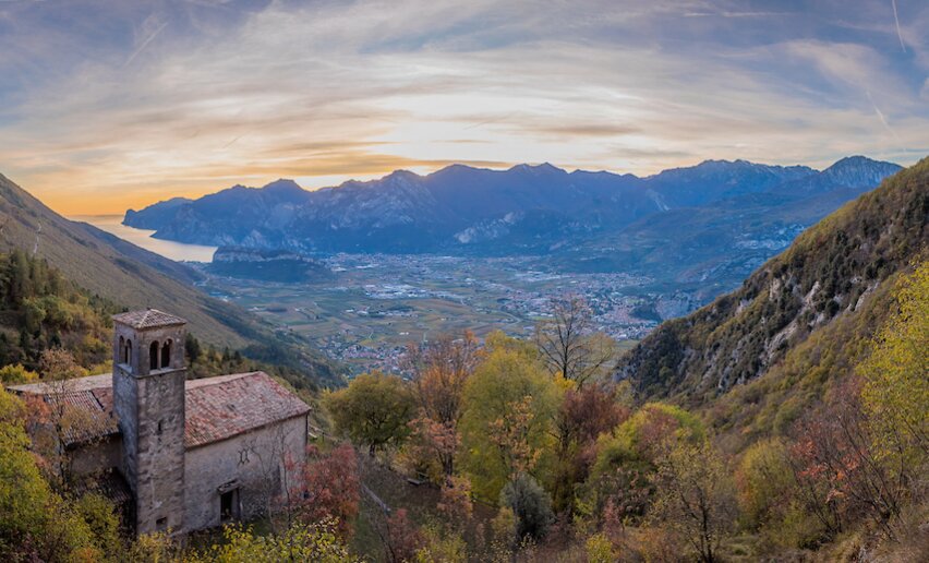
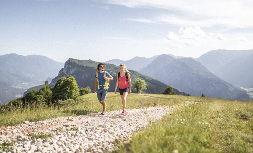
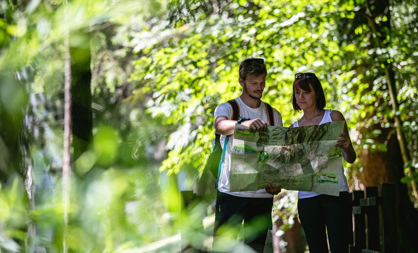
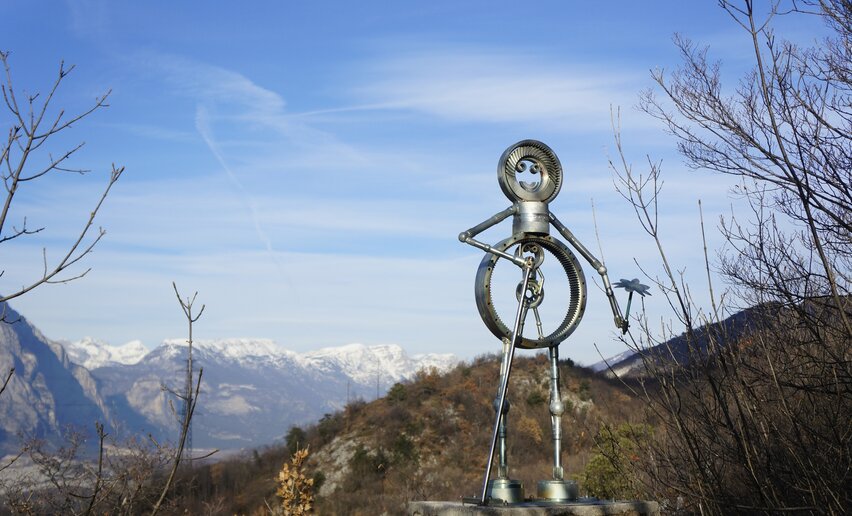
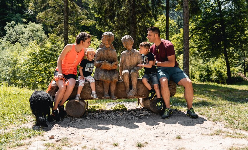
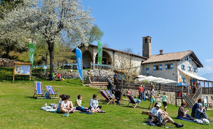
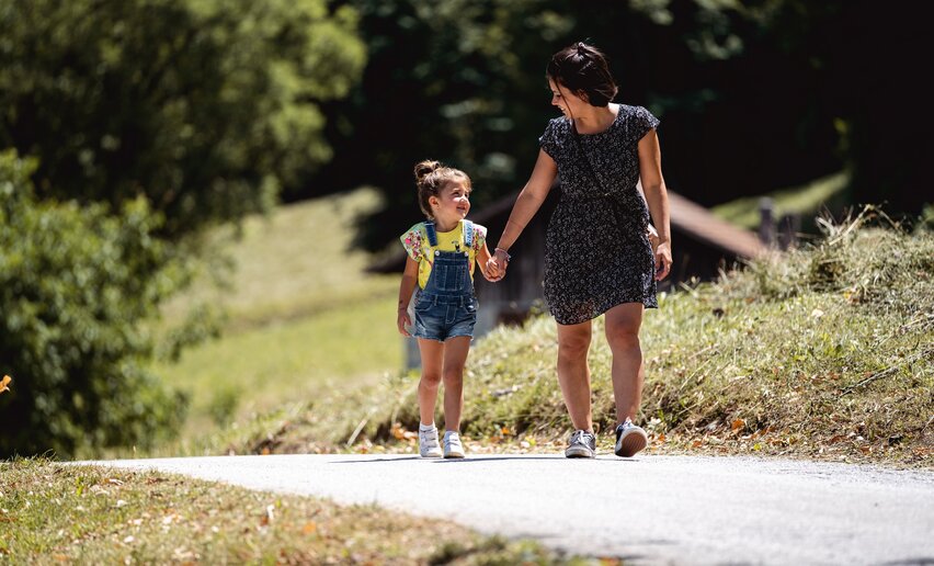
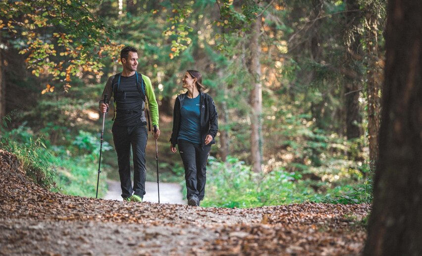
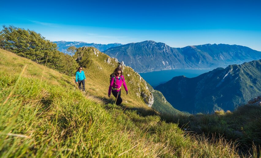
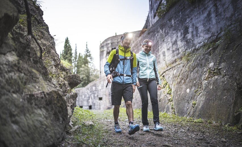
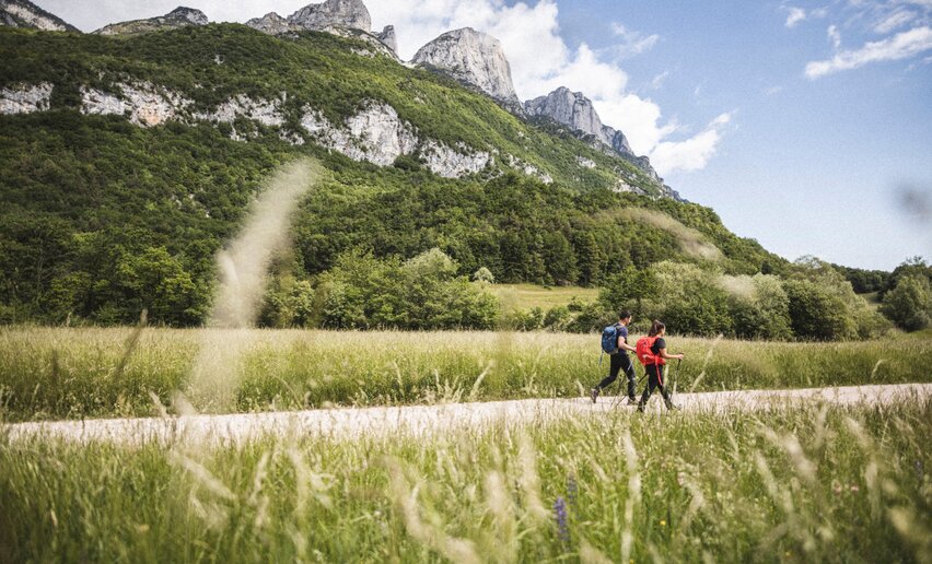
Tourist paths, hiking paths, paths for experienced hikers, "Via Ferrata"
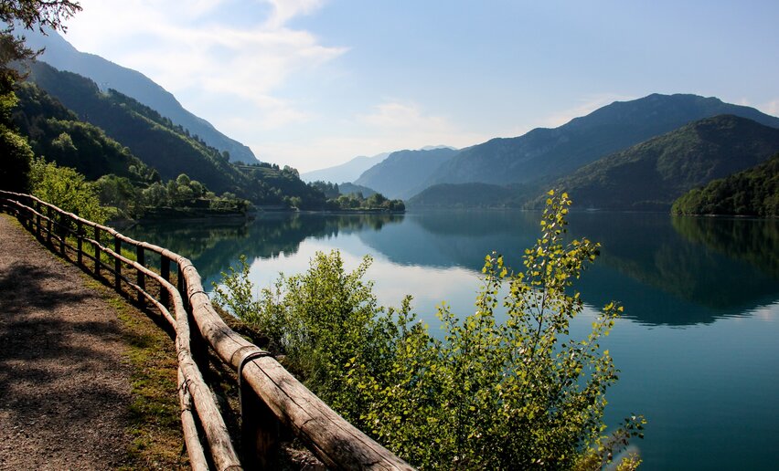
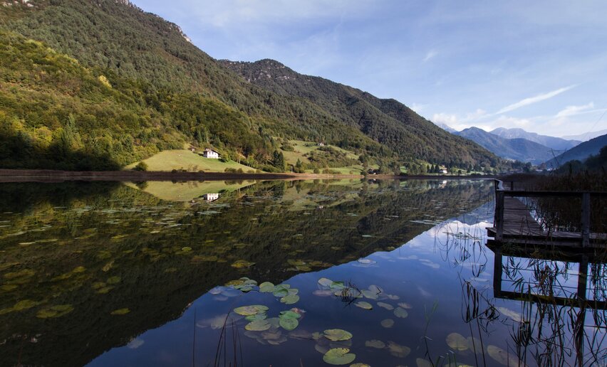
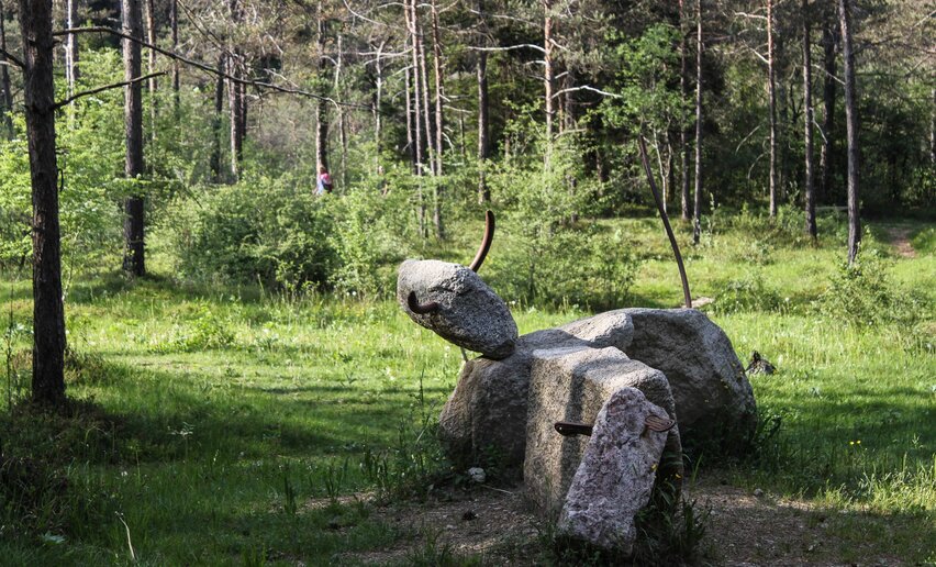
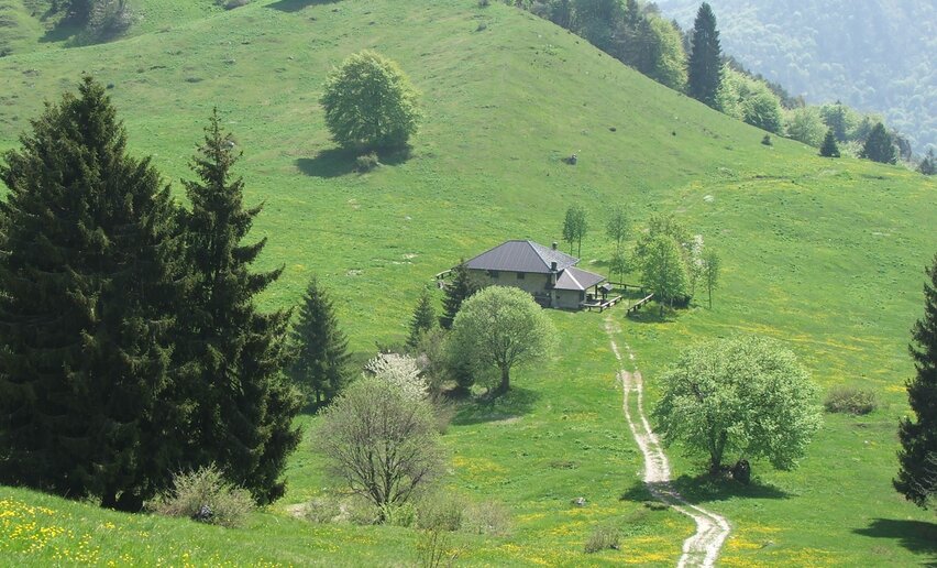
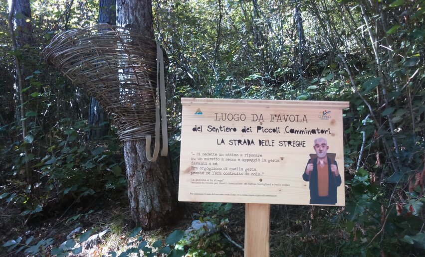
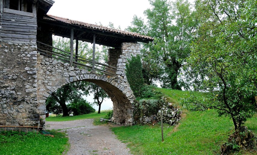
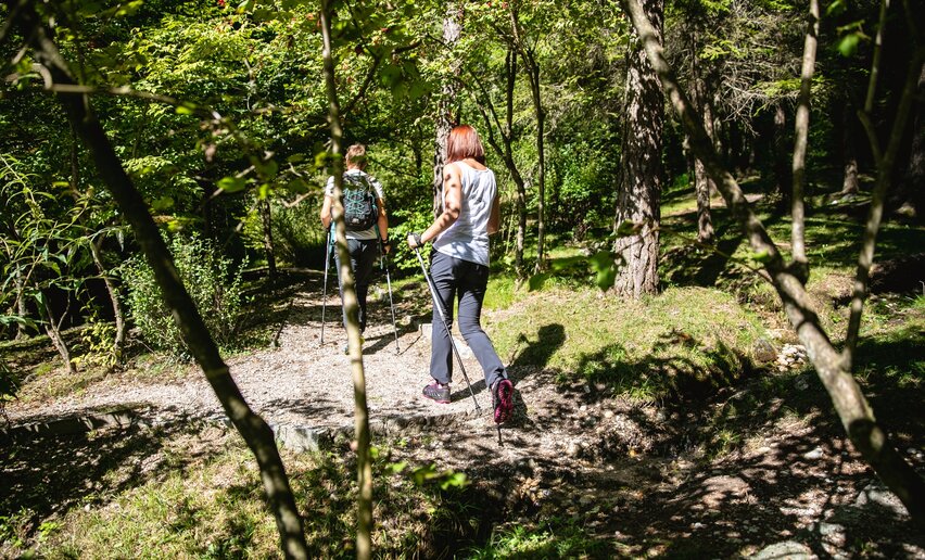
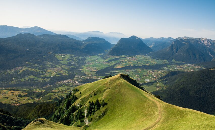
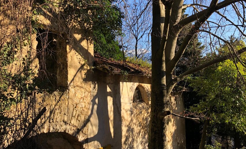
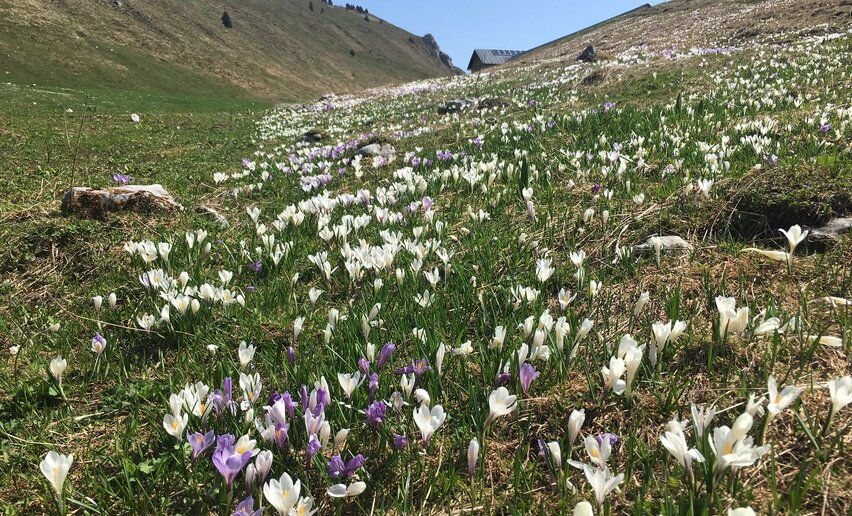
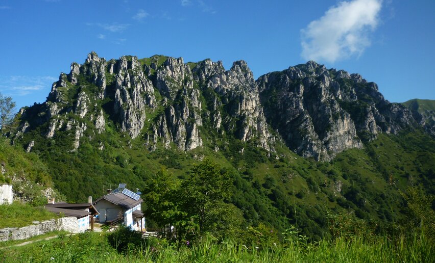
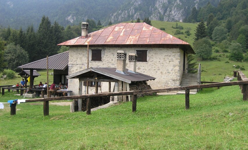
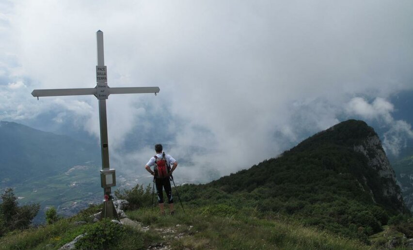
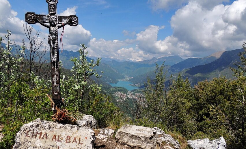
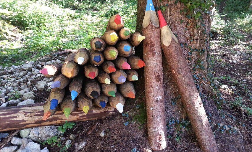
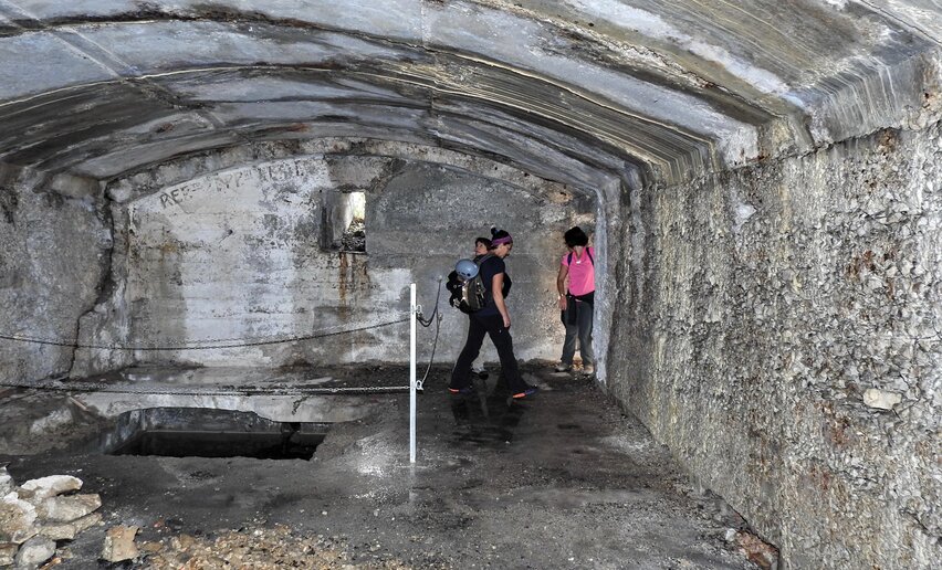
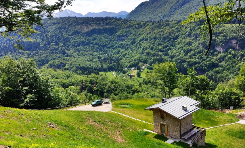
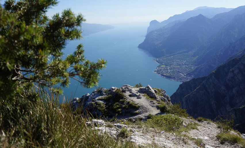
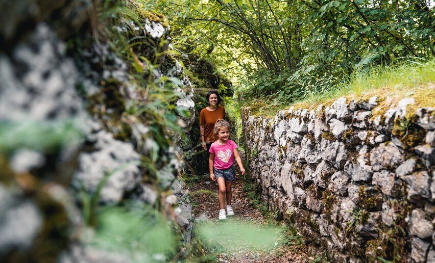
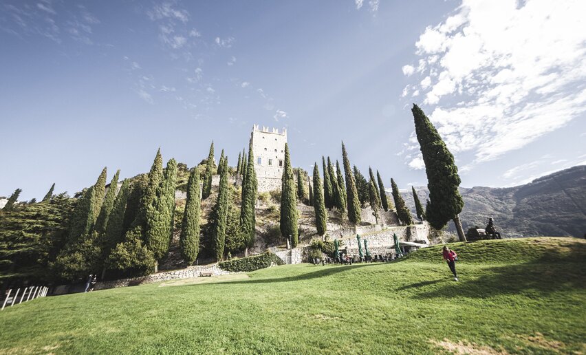
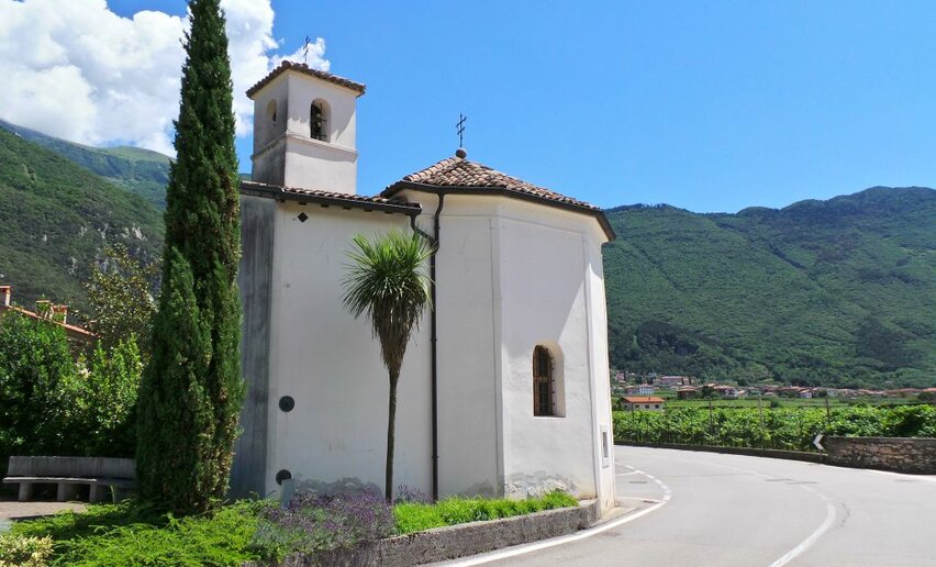
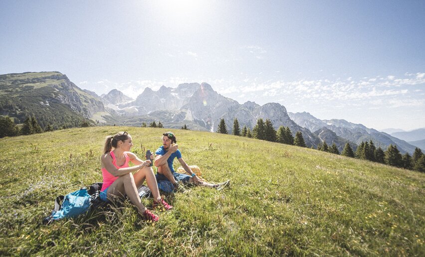
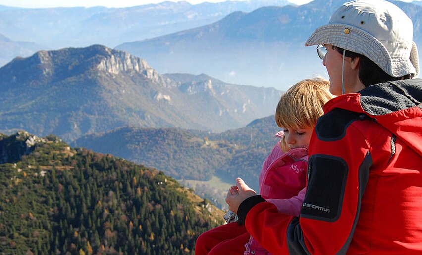
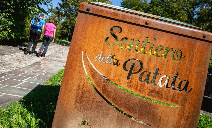
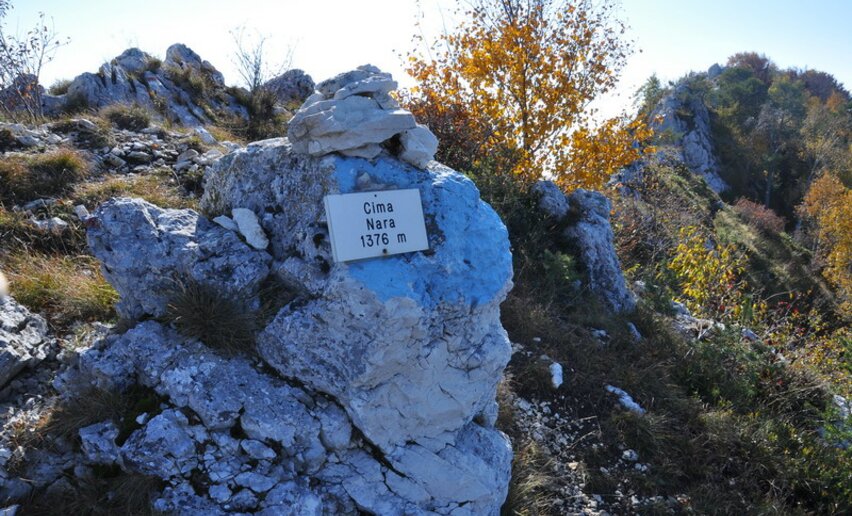
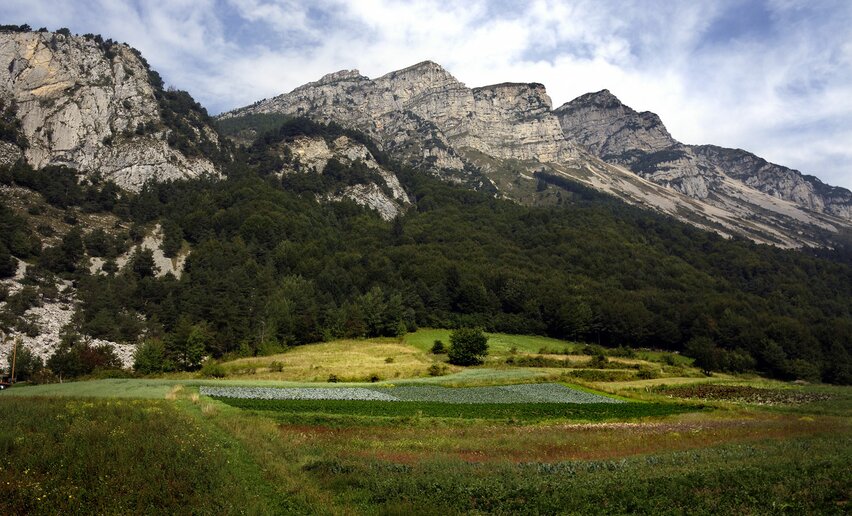
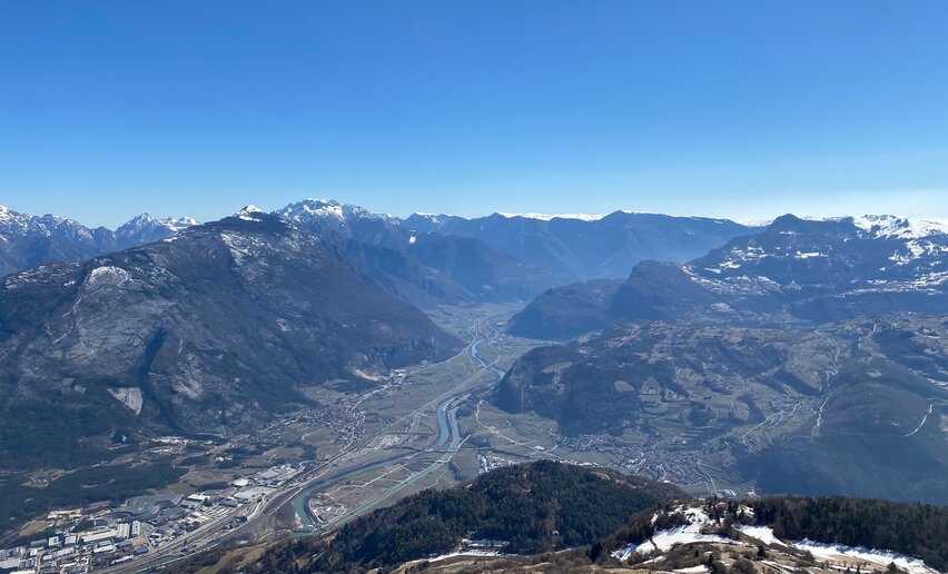
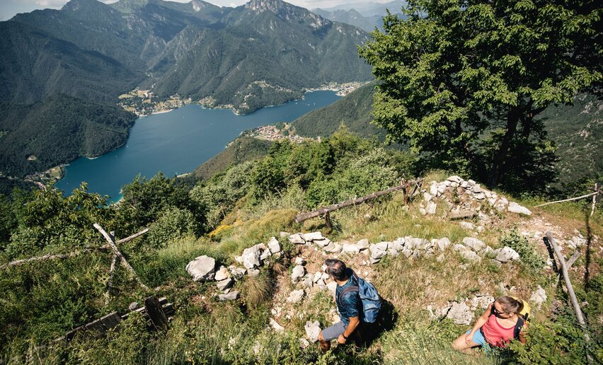
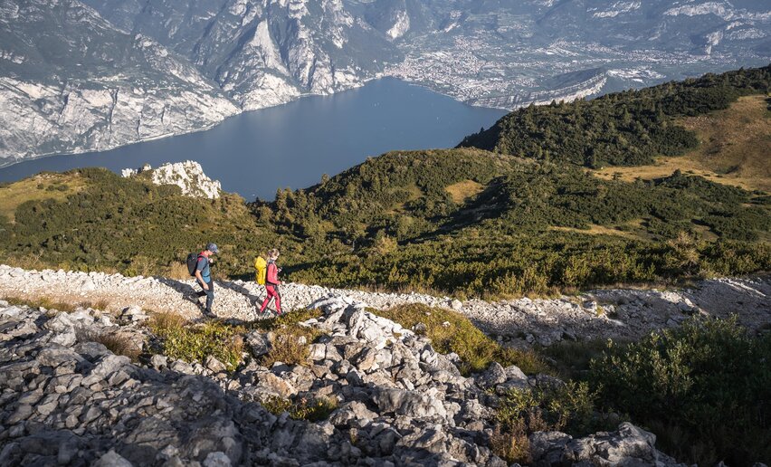
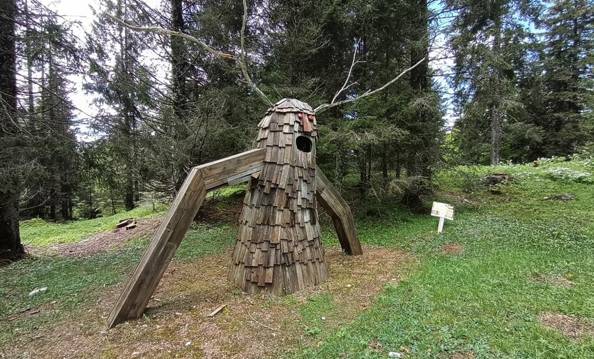
Mount Faè trenchesMountain tour+ INFO (GPX KML)Duration: h 0:20Length: 1,1kmAscent: 27mShort loop of about half an hour starting from SP45 to visit the trenches of Mount FaéDifficulty: EasyLedro Alps Trek Alpiedi - Leg 1: from Storo to TremalzoMountain tour+ INFO (GPX KML)Duration: h 10:00Length: 27,8kmAscent: 1.501mThe ascent from Storo to Tremalzo offers spectacular views over Valle di Ledro and Valle del Chiese.Difficulty: DifficultWWI: from S. Giovanni to Cima RoccaMountain tour+ INFO (GPX KML)Duration: h 3:31Length: 6,5kmAscent: 598mThis trail is highly recommended for all history fans: a visit to the system of tunnels in Cima Rocca together with breathtaking views of Lake GardaDifficulty: IntermediateBiacesa - LedroPieve - Memories on showHiking trail+ INFO (GPX KML)Duration: h 0:30Length: 1,6kmAscent: 19mPieve lies on the western shore of Lake Ledro. Its turquoise water is not the only attraction of the village though. Among its picturesque streets are to be found traces of the history of the village and of Valle di Ledro.Difficulty: EasyPieve di Ledro“Once upon a time there was a castle” pathHiking trail+ INFO (GPX KML)Duration: h 0:40Length: 1,0kmAscent: 38mIn the centre of the village of Tenno, just below the castle, you will find Borgo di Frapporta, the oldest part of the village. The point of departure of the itinerary is in front of the ogive door that allows the entrance to the burg.Difficulty: EasyTennoGardaTrek - Top Loop 7: Back to the waterLong distance hiking trail+ INFO (GPX KML)Duration: h 2:50Length: 7,6kmAscent: 630mA breathtaking finale for the Top Loop of GardaTrek: take the cable car down to Monte Baldo and return by ferry to get back to where you started from. Difficulty: IntermediateMountain hut Damiano Chiesa - Monte AltissimoFrom Malga Campo to Monte StivoMountain tour+ INFO (GPX KML)Duration: h 4:00Length: 8,4kmAscent: 687mThis is a trail for experienced hikers which leads to Cima Bassa and then along the ridge to the summit of Stivo, one of the most spectacular viewing points in Garda TrentinoDifficulty: IntermediateMalga CampoMonte San Martino in Lomaso (from S. Giovanni)Mountain tour+ INFO (GPX KML)Duration: h 2:00Length: 6,5kmAscent: 157mEasy walk to the archaeological site on the top of Monte San Martino that dominates the Valley of Giudicarie (do not confuse this area with the one above the village of Campi)Difficulty: EasySan Giovanni al Monte19. Marmitte, Castel Penede and Strada Santa LuciaHiking trail+ INFO (GPX KML)Duration: h 2:00Length: 5,8kmAscent: 194mAn easy hike through historic locations with a marvellous view over Lake GardaDifficulty: EasyTorbole sul GardaGrotta Camerona and Tenno lakeMountain tour+ INFO (GPX KML)Duration: h 4:00Length: 10,6kmAscent: 292mAn excursion through history and nature. From the vast Grotta Camerona to the splendid Lake Tenno with its surrounding mountains and the quaint medieval village.Difficulty: IntermediateBallinoCooperazione PathHiking trail+ INFO (GPX KML)Duration: h 2:05Length: 6,5kmAscent: 286mThe itinerary is signposted with panels representing Don Lorenzo Guetti.Difficulty: IntermediateLaridoBlossom in DromaèMountain tour+ INFO (GPX KML)Duration: h 5:52Length: 12,1kmAscent: 735mDromaè is among the most beautiful spots in Valle di Ledro, particularly late in the Spring. Green meadows, unparalleled views over the Lake, wild flowers and historical traces make for a spectacular walk.Difficulty: IntermediateMezzolagoGreat War: Doss Casina and Dosso AltoMountain tour+ INFO (GPX KML)Duration: h 3:20Length: 7,2kmAscent: 356mA hike through some of the First World War sites where the Italian Futurists foughtDifficulty: IntermediateMalga Zures - NagoGardaTrek - Top Loop 5: Across the former Austrian FrontLong distance hiking trail+ INFO (GPX KML)Duration: h 4:00Length: 12,3kmAscent: 1.797mA breathtaking descent from the over 2000 metres a.s.l. of the pastures of Monte Stivo to Nago in the valley floor, across the former front of teh Great WarDifficulty: DifficultMountain hut Prospero Marchetti - Monte StivoThe Old Pinza RoadMountain tour+ INFO (GPX KML)Duration: h 4:32Length: 10,5kmAscent: 1.509m Itinerary that follows the signed path 402 from Bocca di Trat, at the border with Valle di Ledro, to Riva del Garda along one of the historic roads of Garda TrentinoDifficulty: DifficultHut Nino Pernici - Bocca di TratLedro Alps Trek Alpiedi - Leg 4: from Rifugio Pernici to Bivacco CampelMountain tour+ INFO (GPX KML)Duration: h 8:00Length: 18,2kmAscent: 620mThe Peace Path, which runs along the Front of the Great War, links Rifugio Pernici to Monte Cadria, the highest point in the whole of Valle di Ledro. Difficulty: DifficultRifugio PerniciGardaTrek - Top Loop 6: In the Garden of EuropeLong distance hiking trail+ INFO (GPX KML)Duration: h 7:00Length: 11,3kmAscent: 1.839mThis stage takes you to Monte Baldo, renowned for the exceptional variety of its flora (it's therefore known as "Garden of Europe") and the incredible views over Lake Garda.Difficulty: DifficultNagoMalga PlazMountain tour+ INFO (GPX KML)Duration: h 4:22Length: 10,2kmAscent: 910mTrekking on the mountains in the Adamello Brenta Natural Park.Difficulty: IntermediateStenicoMonte CadriaMountain tour+ INFO (GPX KML)Duration: h 6:00Length: 11,9kmAscent: 1.318mThe ascent from the woods of Concei to the top of Monte Cadria is among the most demanding that Valle di Ledro has to offer, but also one of the most rewarding.Difficulty: DifficultLocalità Ex-Centrale, ConceiMalga NardisMountain tour+ INFO (GPX KML)Duration: h 7:00Length: 15,3kmAscent: 1.220mA panoramic and little-known ring route on the trail of the wonders of the local flora and fauna.Difficulty: DifficultFrazione Cornelle, FiavèMonte CaroneMountain tour+ INFO (GPX KML)Duration: h 7:00Length: 14,7kmAscent: 1.151mCircular route that runs along the border between Trentino and Lombardy, once the last frontier of the Habsburg Empire, as is testified by the military fortifications that are to be seen along the way.Difficulty: DifficultCar Park, Via San Giacomo, PrèGarda Trek - Top Loop: The crown of Garda TrentinoLong distance hiking trail+ INFO (GPX KML)Duration: h 47:00Length: 93,3kmAscent: 1.972m7 challenging stages from one mountain hut to the next, from the shores of the lake to 2000 m and above, touching on all of the peaks surrounding the northern shores of Lake Garda.Difficulty: DifficultRiva del GardaGalleria RiccabonaMountain tour+ INFO (GPX KML)Duration: h 1:00Length: 2,2kmAscent: 218mVery easy route unfolding from Malga Trat to the slopes of Mazza di Pichea, where some fortifications dating back to the Great War are located.Difficulty: EasyMalga TratDefensionsmauerMountain tour+ INFO (GPX KML)Duration: h 3:00Length: 7,8kmAscent: 373mFrom war to peace: the walkway linking the Austrian fortifications dating back to the Great War now makes for a beautiful itinerary for history enthusiasts, hiking lovers and those who just want to enjoy a great view. Return along the Ponale path, once the main link between Valle di Ledro and Riva del Garda and battleground during the Great War. The rock formations and the vegetation, influenced by the mild climate of Lake Garda, give to the landscape a Mediterranean-like appearance.Difficulty: IntermediateBiacesaSentiero del LatteHiking trail+ INFO (GPX KML)Duration: h 2:00Length: 7,3kmAscent: 116mEmbark on a journey to explore the rural mountain economy of Fiavé and Favrio, centred around the production of milk and its various derivatives.Difficulty: EasyFiavéFrom waterfall to waterfallMountain tour+ INFO (GPX KML)Duration: h 3:00Length: 7,2kmAscent: 311mCircular route along the old Roman road to Croina, among natural and historical wonders. Difficulty: IntermediateTiarno di SottoWalking around Lake LedroHiking trail+ INFO (GPX KML)Duration: h 2:30Length: 9,5kmAscent: 33mWhoever visits Valle di Ledro can’t miss the promenade along the shore of Lake Ledro, with its four beaches and its villages (Pieve, Mezzolago and Molina).Difficulty: EasyPieve di LedroSentiero del Troc - Lago d'AmpolaHiking trail+ INFO (GPX KML)Duration: h 1:30Length: 6,2kmAscent: 58mLake Ledro is not the only lake in Valle di Ledro. Difficulty: IntermediateTiarno di SopraExploring Ledro Land ArtHiking trail+ INFO (GPX KML)Duration: h 1:00Length: 2,6kmAscent: 67mLedro Land Art is an environmental art park immersed in the pinewood of Pur, one of the green lungs of the Valle di Ledro, where artistic creativity meets nature.Difficulty: EasyPurMalga Giù - San MartinoMountain tour+ INFO (GPX KML)Duration: h 5:00Length: 13,3kmAscent: 670mAscent from the pinewood of Pur to the alpine meadows of Malga Giù and Ca’ de Mez, on the mountains above Molina. Descent towards Pieve passing by the little church of San Martino, an ancient hermitage offering a stunning view over Lake Ledro and Val Concei.Difficulty: IntermediatePurWWI: Monte CornoMountain tour+ INFO (GPX KML)Duration: h 3:10Length: 6,9kmAscent: 521mA historical hike up the slopes of Mount Corno, offering magnificent views of Lake Garda, Arco, the Sarca Plain, and Lake Loppio.Difficulty: IntermediateNago - Parking place CoelPonale Path (from Ledro)Mountain tour+ INFO (GPX KML)Duration: h 4:00Length: 10,5kmAscent: 307mFor more than a century the Ponale road has enchanted travellers. This route is ideal for all those who want to enjoy a nice walk and a breath-taking view over Lake Garda and the surrounding mountains. Difficulty: IntermediateBiacesaCima AvezMountain tour+ INFO (GPX KML)Duration: h 2:00Length: 9,1kmAscent: 220mVery easy route, ideal for families looking for a day trip in the mountains. Difficulty: EasyTremalzo - Albergo GardaBezzecca – Val Molini – Santa LuciaHiking trail+ INFO (GPX KML)Duration: h 1:15Length: 4,7kmAscent: 62mTo the discovery of one of the little side valleys of Valle di Ledro, among green meadows and historical sites.Difficulty: EasyBezzeccaBocca Trat - Cima ParìMountain tour+ INFO (GPX KML)Duration: h 4:30Length: 9,7kmAscent: 551mCima Parì is one of the most stunning viewpoints in Valle di Ledro. On a clear day, it offers views sweeping from Lake Ledro to Lake Garda, from the Dolomites to Adamello. Difficulty: IntermediateCar Park, Malga TratMadonnina di BezzeccaHiking trail+ INFO (GPX KML)Duration: h 1:30Length: 4,3kmAscent: 94mIt takes just a few minutes from the village to reach the Madonnina of Bezzecca, a nice spot with a beautiful view over Lake Ledro. Val di Mulini stretches through meadows and barns. Difficulty: EasyBezzeccaLedro Trek LowMountain tour+ INFO (GPX KML)Duration: h 8:00Length: 18,0kmAscent: 375mStart from the Tourist Office in Pieve. We enter the village, we turn into Via Rabaglia and we take the SAT 454 path. At the first bend, instead of continuing along the numbered path, we take the path on the right. We walk along this path to Mezzolago and then we continue downhill along Via Dromaè. After a few hundred metres we take the path on the left and we get into the wood. At the top of the ascent we turn right, and we start walking along a flat path. As we reach For di Bella, in sight of a hut, we take the left path and we resume the uphill climb until we reach the forestry road. Before the bend we take the path on the right and we start the descent towards Molina. At the fork with the path leading to the Madonnina we suggest you make a little detour to enjoy the wonderful view. Once we reach the asphalt, we walk downhill along Via dei Colli to the Pile-Dwellings Museum. We walk along the lake and at the limestone kiln we take the path on the left and we start walking uphill in the wood. We follow the path to Pur and we reach Via Casarino. We turn right and the fork we turn left into the road leading to Malga Cita. We reach the start of Ledro Land Art, we enter the pinewood, we cross the dry torrent bed and we start walking uphill. We reach the forestry road and then we turn right. We continue along the forestry road and we reach Via al Roccolo and we start our descent to Pieve, first along the road and then along the bike path.Difficulty: DifficultPieve di LedroSentiero dell'AcquaMountain tour+ INFO (GPX KML)Duration: h 3:15Length: 10,2kmAscent: 266mA walk that celebrates the forces of nature, like water with its healing properties and ability to shape and fascinate: from Comano Spa to the deep gorge of the Canyon del Limarò, continuing along the river Sarca, one of the main watercourses in Trentino, that connects the Adamello - Presanella & Brenta Dolomites glaciers to Lake Garda.Difficulty: IntermediatePonte ArcheFrom Malga Campo to Rifugio Altissimo above Lake GardaMountain tour+ INFO (GPX KML)Duration: h 3:35Length: 9,4kmAscent: 442mThe mountain hut Rifugio Damiano Chiesa on Monte Altissimo is one of the most popular destinations with hikers in Garda Trentino. This is a variation on the usual route for you to tryDifficulty: IntermediateCark park next to alpine hut GrazianiGardaTrek - Top Loop 2: descent to Lake TennoLong distance hiking trail+ INFO (GPX KML)Duration: h 5:00Length: 11,6kmAscent: 1.140mThis stage goes from a hut to the next, from Nino Pernici to San Pietro, touching the verdant shores of lake Tenno and the evocative medieval village of Canale di Tenno. Difficulty: IntermediateMountain hut Nino Pernici - Bocca di TratPonale Path (from Riva del Garda)Mountain tour+ INFO (GPX KML)Duration: h 3:00Length: 6,4kmAscent: 467mPonale Trail is the best known and most popular in Garda Trentino: spectacular as its winds sheer above the lake, a classic trek you can't afford to miss.Difficulty: EasyVia Monte Oro - Riva del GardaMarocche Nature ReserveMountain tour+ INFO (GPX KML)Duration: h 2:00Length: 6,1kmAscent: 119mA walk in a truly unique environment in another dimension of time and spaceDifficulty: IntermediateParking space Loc. Marocche - Drena“La strada delle streghe” pathHiking trail+ INFO (GPX KML)Duration: h 1:15Length: 2,6kmAscent: 115mIn Balbido, take the road that goes towards val Marcia as far as Le Cross where you will find an open space and the sign indicating the start of the walk.Difficulty: EasyBalbidoLedro Alps Trek Alpiedi - Leg 3: from Bivacco Arcioni to Rifugio PerniciMountain tour+ INFO (GPX KML)Duration: h 5:00Length: 11,1kmAscent: 1.008mThe path runs along the Front of the First World War, on the mountainside of Cima d'Oro, Cima Sclapa and Cima Parì.Difficulty: IntermediateBivacco ArcioniSentiero Busatte TempestaMountain tour+ INFO (GPX KML)Duration: h 2:40Length: 7,9kmAscent: 212mThe Busatte - Tempesta Trail is one of the most well-known and popular hikes in the area. Difficulty: EasyBusatte Park - Torbole sul GardaRango, Balbido and Passo DuroneMountain tour+ INFO (GPX KML)Duration: h 2:45Length: 8,3kmAscent: 224mThis is an easy and fascinating walk first through Rango, “one of the most beautiful villages in Italy”, then Balbido, known as Il paese dipinto (the painted village) and Passo Durone.Difficulty: EasyRangoMonte San Martino nel Lomaso (da Lundo)Mountain tour+ INFO (GPX KML)Duration: h 2:30Length: 5,8kmAscent: 258mThis excursion runs almost entirely through the woods leading to the discovery of a place not so well known but very interesting for its archaeological significance.Difficulty: IntermediateLundoCredata FortMountain tour+ INFO (GPX KML)Duration: h 1:00Length: 3,9kmAscent: 279mThis short walk will take you through one of the most interesting places of Val Algone: a small fortress tucked-away in the woods that covers the craggy left side of the valley.Difficulty: EasyVal Algone (700 m)On Monte ValandroMountain tour+ INFO (GPX KML)Duration: h 5:30Length: 10,1kmAscent: 1.031mThis excursion runs along the sides of Banale, immersed in Adamello-Brenta Natural Park.Difficulty: IntermediateSeoBastione - S. Maria Maddalena - Foci San GiacomoHiking trail+ INFO (GPX KML)Duration: h 1:30Length: 4,3kmAscent: 187mShort and easy walk to discover an almost unknown area of Riva del Garda. Difficulty: IntermediateVia Monte Oro - Riva del GardaThe Rio Bianco Waterfall and the Bosco Arte StenicoHiking trail+ INFO (GPX KML)Duration: h 2:00Length: 4,7kmAscent: 149mAlong this captivating itinerary, you will come to appreciate two important aspects of the Parco Naturale Adamello-Brenta: its water and flora. The water element, prime resource for the ecosystem and for mankind, shapes and carves the landscape and is an integral part of this excursion which reaches the heart of the roaring Rio Bianco waterfalls.Difficulty: EasyStenicoFrom Lake Tenno to Canale, a stroll through the countrysideHiking trail+ INFO (GPX KML)Duration: h 1:30Length: 4,5kmAscent: 45mEasy walk around Lake Tenno and as far as Canale, a medieval village belonging to the club of the Most Beautiful Villages of Italy.Difficulty: EasyLake TennoThe S. Vili’s path: through Deggia, Moline & RanzoMountain tour+ INFO (GPX KML)Duration: h 5:00Length: 13,9kmAscent: 341mA walk between nature and history.Difficulty: IntermediateFraz. Deggia, San Lorenzo in Banale - Santuario della Madonna di DeggiaGardaTrek - Top Loop 4: to the balcony over Lake GardaLong distance hiking trail+ INFO (GPX KML)Duration: h 7:50Length: 16,3kmAscent: 1.908mAnother uphill stage! From the bottom of the valley there is almost 2000 metres of elevation gain to get to one of the most spectacular viewing points in all of Garda Trentino.Difficulty: DifficultCenigaGreat War: Cima Nodice and the “Scala Santa” or Holy StairsMountain tour+ INFO (GPX KML)Duration: h 2:01Length: 3,1kmAscent: 294mA short hike in the mountains sheer above Lake Garda following the trail of the First World WarDifficulty: IntermediatePregasinaGardaTrek - TopLoop 2: descent to Lake Tenno (Alternative route)Long distance hiking trail+ INFO (GPX KML)Duration: h 4:30Length: 12,3kmAscent: 1.184mSentiero della Regina is often damaged by bad weather. This alternative route bypasses the interrupted stretch and reconnects to the official Garda Trek Top Loop track in Canale.Difficulty: IntermediateNino Pernici mountain hut - Bocca di TratLedro Trek Medium - Stage 2Mountain tour+ INFO (GPX KML)Duration: h 6:30Length: 16,6kmAscent: 820mLedro Trek Medium is a two-day trek along mountainside trails overlooking Lake Ledro. Highlights of the second stage: Wonderful views of Lake Ledro, Ledro Land Art and Alpine pastures of Sant'Anna.Difficulty: DifficultMolina di LedroFrom Cornelle through the surrounding woodsMountain tour+ INFO (GPX KML)Duration: h 3:30Length: 8,0kmAscent: 394mThis excursion, running entirely through the woods, with short stretches bordering the fields, offers an opportunity to experience, first-hand, the beauty of the alpine landscape.Difficulty: IntermediateLoc. Cornelle Fiavé10. To the Hermitage Eremo di San GiacomoMountain tour+ INFO (GPX KML)Duration: h 2:15Length: 4,2kmAscent: 615mA hike up the slopes of Monte Stivo from Bolognano to the chapel which overlooks the town and the Arco area and offers a good view point.Difficulty: IntermediateBolognano - car parking at the churchLe Tre Sorelle: the Three SistersMountain tour+ INFO (GPX KML)Duration: h 6:00Length: 14,6kmAscent: 831mA less well-known corner of Valle di Ledro, at the border with Valle del Chiese and the Giudicarie. Difficulty: DifficultTiarno di SottoWalking tour of the mountain huts of Val di ConceiMountain tour+ INFO (GPX KML)Duration: h 7:00Length: 14,6kmAscent: 816mA journey to the discovery of the rural economy of Valle di Ledro.Difficulty: IntermediateRifugio Al FaggioMonte S. MartinoMountain tour+ INFO (GPX KML)Duration: h 3:00Length: 6,2kmAscent: 428mTrekking with a beautiful view over the Comano valley.Difficulty: IntermediatePasso DuroneMalga Movlina and Rifugio XII ApostoliMountain tour+ INFO (GPX KML)Duration: h 5:30Length: 11,4kmAscent: 825mThis excursion leads to the heart of Parco Naturale Adamello Brenta and offers breath-taking views of the Dolomites and the Adamello, passing through the spectacular Val Algone to reach Rifugio XII Apostoli (2.847 m).Difficulty: IntermediateMalga Movlina"Il Pifferaio magico e le palafitte" pathHiking trail+ INFO (GPX KML)Duration: h 1:30Length: 4,0kmAscent: 37mFrom Fiavè follow the indications to the archaeological area, as far as the car park on the right-hand side of the main road.Difficulty: EasyFiavé2 days in the mountains of Garda Trentino and 1 night in Rifugio PerniciMountain tour+ INFO (GPX KML)Duration: h 13:45Length: 25,4kmAscent: 1.707mSleeping in a mountain hut is always a thrill. This excursion has an overnight stay in the mountains followed by a super panoramic hike back down to Riva del GardaDifficulty: DifficultRiva del GardaBosco Caproni and Trenches of VastrèMountain tour+ INFO (GPX KML)Duration: h 2:00Length: 5,8kmAscent: 217mA nature walk which in just a few kilometres manages to give a fascinating insight into the historical events which left their mark on Garda TrentinoDifficulty: EasyParking place at the bridge - ArcoGardaTrek - Top Loop 3: a long descent to the River SarcaLong distance hiking trail+ INFO (GPX KML)Duration: h 7:55Length: 20,3kmAscent: 1.240mFrom San Pietro hut (1000 m above sea level) to the valley bottom again. Another stage characterized by a great variety of lanscapes as you descend to the Sarca river shores. Difficulty: DifficultMountain hut San Pietro - Monte CalinoMonte TomeabrùMountain tour+ INFO (GPX KML)Duration: h 4:30Length: 9,7kmAscent: 352mMonte Tomeabrù offers a wonderful view over Lake Ledro. This route is a good alternative to the well-trodden path to Cima Parì.Difficulty: IntermediateMalga TratGreat War: from Malga Grassi to Rifugio PerniciMountain tour+ INFO (GPX KML)Duration: h 2:08Length: 2,5kmAscent: 558mThis is without doubt one of the most popular hiking trails in Garda Trentino. Short and not too hard, it leads to one of the busiest mountain huts in the area.Difficulty: IntermediateCampi - Parking place Malga GrassiTour of the malghe of MolinaMountain tour+ INFO (GPX KML)Duration: h 6:00Length: 13,8kmAscent: 1.026mFrom malga to malga, discovering the alpine pastures above Molina, between Monte Corno and Monte Tremalzo.Difficulty: DifficultPurMonte BiainaMountain tour+ INFO (GPX KML)Duration: h 3:35Length: 7,3kmAscent: 288mHike to the Biaina Mount with its 360° view that goes from Lake Garda to the DolomitesDifficulty: IntermediateSan Giovanni al MonteMonte CasaleMountain tour+ INFO (GPX KML)Duration: h 5:00Length: 11,6kmAscent: 1.012mFrom the top, the view spans across Trentino’s peaks and 7 lakes.Difficulty: IntermediateComano PaeseCoste di BaoneMountain tour+ INFO (GPX KML)Duration: h 2:00Length: 4,9kmAscent: 162mWith its rocky slope and hillsides covered in olive groves Monte Baone is a landmark of Garda Trentino. From here there is an absolutely spectacular view over the entire area.Difficulty: EasyParcheggio al Calvario - ArcoThe Dürer Promenade in ArcoHiking trail+ INFO (GPX KML)Duration: h 2:21Length: 7,6kmAscent: 157mA walk from the centre of Arco to Varignano, in the footsteps of the painter Albrecht Dürer who at the end of the 15th century was inspired by these places to paint the castle and town.Difficulty: EasyArco - city centerBastione and Santa Barbara, the lords of Riva del GardaMountain tour+ INFO (GPX KML)Duration: h 1:45Length: 2,8kmAscent: 544mFrom Riva del Garda to Bastione and then on up to Santa Barbara: this hike touches on two of the symbols of the town perched on the mountainside above Riva del GardaDifficulty: IntermediateRiva del GardaPasso della Morte: a path through nature and legendMountain tour+ INFO (GPX KML)Duration: h 3:30Length: 7,7kmAscent: 510mThis is a long walk that will take you through the leafy forests that drape the sides of “Godesi”, (the north-western side of Mount Casale), a location rich in historic and cultural elements.Difficulty: IntermediateComano PaeseFrom the church of San Lorenzo to Bussè hillHiking trail+ INFO (GPX KML)Duration: h 1:00Length: 3,0kmAscent: 109mAn easy walk that connects two viewpoints near Tenno: the Grom hill in the village of Frapporta and the educational nature path on the Bussè hill.Difficulty: EasyCar park (Fire Station) - TennoLedro Alps Trek Alpiedi - Leg 2: from Tremalzo to Bivacco ArcioniMountain tour+ INFO (GPX KML)Duration: h 8:00Length: 23,7kmAscent: 1.440mThis route runs all along the southern side of Valle di Ledro, from the verdant meadows of Tremalzo to the rocky peaks of Monte Carone.Difficulty: DifficultPasso TremalzoChurch of San Giovanni - Bivacco ArcioniMountain tour+ INFO (GPX KML)Duration: h 2:30Length: 4,7kmAscent: 436mClimb up from the little church of San Giovanni to the Arcioni bivouac with its panoramic terrace.Difficulty: EasyBiacesa – sports field (470 m)Monte Gaggio e GaggioloMountain tour+ INFO (GPX KML)Duration: h 4:30Length: 12,8kmAscent: 127mPleasant walk in little-known areas of Garda Trentino passing through Gaggio and Gaggiolo. Difficulty: EasyPietramurataCima RoccaMountain tour+ INFO (GPX KML)Duration: h 3:30Length: 7,8kmAscent: 660mTrek for hikers with experience along the side of the Ledro Alps facing Lake Garda. Difficulty: IntermediateBiacesaLedro Alps Trek Alpiedi - Leg 5: from Bivacco Campel to StoroMountain tour+ INFO (GPX KML)Duration: h 8:00Length: 22,0kmAscent: 1.310mThis route runs downhill through meadows, broadleaved trees and malghe, astride two valleys: Valle di Ledro and Valli Giudicarie.Difficulty: IntermediateFrom Dro to Braila along the Teacher's TrailMountain tour+ INFO (GPX KML)Duration: h 4:30Length: 10,9kmAscent: 415mAn excursion from Dro to the mountain hamlet of Braila, along the historic trail which cuts across the slopes of Monte Varino with a spectacular view over the Sarca Valley.Difficulty: IntermediateDro - Piazza della RepubblicaHidden Treasures: Pranzo, a village and its craftsHiking trail+ INFO (GPX KML)Duration: h 0:30Length: 1,3kmAscent: 62mA visit to the open air art installation in the village of Pranzo (Tenno): wooden panels made by the local school of sculpture in honour of the trades and professions of days gone by.Difficulty: EasyPranzo di TennoOpen Air Gallery: art in the open air in DrenaHiking trail+ INFO (GPX KML)Duration: h 0:21Length: 0,8kmAscent: 53mLots of different unexpected installations, objects and splashes of colour which transform the woods into an open air art galleryDifficulty: EasyBraila - Parking placeAround Monte TremalzoMountain tour+ INFO (GPX KML)Duration: h 6:00Length: 12,1kmAscent: 594mThe route alternates the meadows of Tremalzo and Giù to the woods of Caset and the rocks and pines of the Marogna. From the Corno della Marogna the eye can sweep all around. Northwards towards Valle di Ledro, westwards towards the Adamello group, to the east towards Lake Garda and to the south towards the Alpine foothills.Difficulty: IntermediateRifugio GaribaldiThe Archaeological Area San Martino in CampiMountain tour+ INFO (GPX KML)Duration: h 1:05Length: 2,3kmAscent: 125mAn easy walk to the San Martino Archaeological Area near Campi by Riva del GardaDifficulty: EasySan Martino Area parking - Road to Capanna GrassiVal Marcia: The Witches TrailMountain tour+ INFO (GPX KML)Duration: h 3:00Length: 7,0kmAscent: 794mAt the beginning of the valley seven crosses were built in 1656 to keep away the witches, who were thought to cast courses on the inhabitants, causing damages to the villages and the fields. This itinerary isn’t a strenuous one and it’s perfect also for children and seniors, as long as trained. In fact, you will have to face a steep climb that will bring you up at 1580 metres. Val Marcia, located at the south end of Bleggio, is enclosed by Mount Altissimo and Mount Cogorna and traversed by the river Duina and its little tributaries. Discover this wild valley and admire such an untouched territory offering many wonderful glimpses.Difficulty: IntermediateBalbidoHiking to the mountain hut San Pietro on Monte CalinoMountain tour+ INFO (GPX KML)Duration: h 3:57Length: 9,1kmAscent: 420mThe hike up to hut San Pietro is one of the most popular for locals as well as for tourists for its ease of access, excellent cuisine and spectacular panoramic views of Lake GardaDifficulty: IntermediateVille del MonteCima Bal and Cima NaraMountain tour+ INFO (GPX KML)Duration: h 8:00Length: 14,2kmAscent: 937mThe path runs through the meadows of Leano and Guil and reaches Cima Nara and Cima Bal, which offer spectacular views over Valle di Ledro and Lake Garda.Difficulty: DifficultPrèLaghel, echoes of literature and religious devotionHiking trail+ INFO (GPX KML)Duration: h 1:50Length: 5,5kmAscent: 222mA trail which winds along the Stations of the Cross celebrated in the poetry of R. M. RilkeDifficulty: EasyArcoMadonna delle ferleMountain tour+ INFO (GPX KML)Duration: h 2:00Length: 5,3kmAscent: 196mEasy and short, but nonetheless very satisfying, route, which unveils a less known corner of Valle di Ledro. Difficulty: EasyMonte Colodri - ColtMountain tour+ INFO (GPX KML)Duration: h 4:00Length: 10,0kmAscent: 341mA hike along the Colodri and Colt ridges, natural balconies overlooking the Sarca Valley. Please note this trail is only for sure-footed experienced hikers!Difficulty: IntermediateCentre - ArcoVal ConceiHiking trail+ INFO (GPX KML)Duration: h 2:30Length: 8,5kmAscent: 143mThe Val Concei naturalistic path is surrounded by nature.Difficulty: EasyLenzumoGorg d'AbissHiking trail+ INFO (GPX KML)Duration: h 1:00Length: 1,4kmAscent: 121mPerfect route for families with children looking for a light and quiet walk but not wanting to renounce to a dash of outdoor adventure.Difficulty: EasyTiarno di SottoGiro della Madonnina di BestaMountain tour+ INFO (GPX KML)Duration: h 2:30Length: 6,5kmAscent: 385mOne doesn’t need to climb the mountains of Valle di Ledro to enjoy a breathtaking view over Lake Ledro. The Madonnina of Besta dominates the village below and encompasses at a glance the whole of Lake Ledro.Difficulty: IntermediateMolina di Ledro, Pile-Dwelling Museum“BoscoArteStenico” pathHiking trail+ INFO (GPX KML)Duration: h 1:10Length: 2,2kmAscent: 71mFrom Stenico, follow the path starting from the natural area of Rio Biancoor directly from La Cros, above the church.Difficulty: EasyBoscoArteStenicoPath of the DefensionmauerMountain tour+ INFO (GPX KML)Duration: h 5:00Length: 8,8kmAscent: 383mThe “Defensionmauer” was the defensive wall built before WWI in the area of Sperone against possible attacks by the Italian infantry and was armed with machine guns. Difficulty: IntermediateVia Monte Oro - Riva del GardaGardaTrek - Medium Loop 2: from the Rifugio San Pietro hut to CenigaMountain tour+ INFO (GPX KML)Duration: h 6:20Length: 12,9kmAscent: 995mA long, downhill hike towards the Sarca Valley from the thick woods of Monte Calino to the orchards surrounding Ceniga, just beside the shore of river Sarca. Difficulty: DifficultMountain hut Rifugio San Pietro - Monte CalinoLoop around Pregasina: Punta Larici and Malga PalaerMountain tour+ INFO (GPX KML)Duration: h 3:30Length: 6,5kmAscent: 441mLoop that leads from Pregasina to Punta Larici, an incredible lookout point overlooking Lake Garda, passing along the "Senter de la Costa" Difficulty: IntermediatePregasinaColle di Santo StefanoHiking trail+ INFO (GPX KML)Duration: h 0:30Length: 1,1kmAscent: 33mOn the traces of history… To the discovery of the war facts which have affected Valle di Ledro in the last two centuries.Difficulty: EasyBezzeccaGardaTrek - Medium Loop: 4 stages around Garda TrentinoMountain tour+ INFO (GPX KML)Duration: h 29:05Length: 72,6kmAscent: 1.033m4 stages hikeable all year round, from the lake shore to more than 1000 m. a.s.l., from Mediterranean vegetation to Alpine woods: one loop, all the variety of Garda Trentino!Difficulty: IntermediateRiva del Garda - via Monte OroGardaTrek Medium Loop 1: from Riva del Garda to Rifugio San PietroMountain tour+ INFO (GPX KML)Duration: h 7:30Length: 17,2kmAscent: 887mStart out with a hike through the valleys and mountain hamlets of Garda Trentino on little-frequented trails and country lanes and enjoyed the quietness of the route.Difficulty: DifficultRiva del Garda - via Monte OroMonte Corno: the balcony above Lake LedroMountain tour+ INFO (GPX KML)Duration: h 6:30Length: 14,3kmAscent: 1.027mFrom lake to mountain passing by the little church of San Martino, once a hermitage.Difficulty: IntermediateCar Park, Via Nuova, PieveGarda Trek - Medium Loop 4: From Bolognano to Riva del GardaMountain tour+ INFO (GPX KML)Duration: h 8:25Length: 23,1kmAscent: 636mNow you have explored the inland area, the trek turns south again, towards the shores of lake Garda, which dominates the last stretch of the GardaTrek Medium LoopDifficulty: IntermediateBolognanoGardaTrek - Medium Loop 3: from Ceniga to BolognanoMountain tour+ INFO (GPX KML)Duration: h 8:20Length: 19,8kmAscent: 713mBetween the Sarca Valley and the slopes of Monte Stivo, this stage of GardaTrek Medium Loop crosses some of the lesser known but equally charming areas of Garda TrentinoDifficulty: IntermediateCenigaHidden Treasures: The Heart of Dro, in the Sarca valleyHiking trail+ INFO (GPX KML)Duration: h 1:20Length: 4,9kmAscent: 63mAn easy walk around Dro, a small town in the Sarca Valley, from the central town square to the chapel of Sant'Abbondio on the hill of the same nameDifficulty: EasyDro - Piazza RepubblicaWalking up to the Castle of ArcoHiking trail+ INFO (GPX KML)Duration: h 1:00Length: 2,9kmAscent: 109mA short urban trail to discover the historic centre of Arco, perfect for anybody on their first visit to Garda Trentino who wants to find out more about the town.Difficulty: EasyArco - city centerTreasures of Sacral Art in ArcoHiking trail+ INFO (GPX KML)Duration: h 2:35Length: 9,7kmAscent: 77mAn easy itinerary which focuses on the historic frescoed churches around Arco, little known gems, the perfect walking tour for lovers of art and architecture.Difficulty: EasyArco - city centerVal Algone: discovery trail in Parco Naturale Adamello BrentaMountain tour+ INFO (GPX KML)Duration: h 3:30Length: 7,2kmAscent: 277mThis is an easy walk along the bottom of Val Algone to discover its past: pastures, barns, farmsteads and the glass industry.Difficulty: IntermediateVal Algone - Parco Naturale Adamello BrentaView from TremalzoHiking trail+ INFO (GPX KML)Duration: h 1:30Length: 4,3kmAscent: 176mEasy mountain walk among mugho pines. With the Adamello group in the background.Difficulty: IntermediateAlbergo GardaSentiero della FedeMountain tour+ INFO (GPX KML)Duration: h 3:30Length: 10,1kmAscent: 253mA walk through the Bleggio region to discover the surrounding hamlets and places of faith: from quaint little churches painted by the Baschenis to the majestic church of S. Croce with its Roman crypt and the chapel guarding inside the miraculous cross, passing numerous shrines and prayer corners, signs of an ancient rural world where faith often blended with legends and superstition.Difficulty: IntermediateGiardino al Sarca di Ponte Arche/Comano TermeThe path through the chestnut grove of DrenaMountain tour+ INFO (GPX KML)Duration: h 1:44Length: 4,2kmAscent: 209mEducational path dedicated to the local culture of the chestnut, in the “maroneri” chestnut grove.Difficulty: EasyDrena - Town CenterThe "Blue Line" of Garda TrentinoMountain tour+ INFO (GPX KML)Duration: h 5:20Length: 15,2kmAscent: 200mA historic itinerary which follows the 1945 line of fortifications from the lakeshore of Riva di Garda to Nago-Torbole.Difficulty: IntermediateRiva del GardaArca di FraporteMountain tour+ INFO (GPX KML)Duration: h 4:30Length: 10,4kmAscent: 789mIt’s hard to explain the emotions one feels while walking through this spectacular natural wonder: the vastness of the cave, the roaring of the waterfalls, the darkness broken here and there by bright light beams penetrating the cave and the sounds of nature echoing all around.Difficulty: IntermediateStenicoSass de Santa CrosMountain tour+ INFO (GPX KML)Duration: h 2:40Length: 7,2kmAscent: 337mThis short excursion, suitable for everyone, is ideal for beginners who wish to discover everything that mountain can offer.Difficulty: IntermediateSanta CroceGarda Trek - LowLoop 2: from Arco to Riva del GardaMountain tour+ INFO (GPX KML)Duration: h 7:10Length: 19,2kmAscent: 241mThe second stage of the Low Loop takes you back to Riva del Garda, touching on Nago and Torbole, then following the lake shore to the point you started from, exploring the eastern shore of Garda Trentino.Difficulty: IntermediateArco - city centerGardaTrek - Low Loop 1: from Riva del Garda to ArcoMountain tour+ INFO (GPX KML)Duration: h 5:55Length: 13,9kmAscent: 424mThe first stage of the trek links the two main towns in Garda Trentino and takes you from Riva del Garda to Arco.Difficulty: IntermediateRiva del Garda - via Monte OroLakeside walkHiking trail+ INFO (GPX KML)Duration: h 1:30Length: 9,8kmAscent: 43mEasy walk on the northern shore of Lake Ledro, through the villages of Pieve and Mezzolago to the Pile-Dwelling Museum of Lake Ledro.Difficulty: EasyPieve di LedroRilke PromenadeHiking trail+ INFO (GPX KML)Duration: h 2:15Length: 7,1kmAscent: 137mA literary stroll in the shadow of Arco Castle, following in the footsteps of the great Austrian poet Rainer Maria Rilke, who drew inspiration from these surroundings. Difficulty: EasyArco - city centerGarda Trek - Low Loop: in the heart of Garda TrentinoMountain tour+ INFO (GPX KML)Duration: h 12:25Length: 32,4kmAscent: 450mGardaTrek Low Loop is an easy trek which allows you to explore the "Busa", the lowland area of Garda Trentino overlooking Lake Garda, and its main towns which are Riva del Garda, Tenno, Arco, Nago and Torbole sul Garda.Difficulty: IntermediateRiva del Garda - via Monte OroS. Croce church: at the foot of Monte CasaleHiking trail+ INFO (GPX KML)Duration: h 2:30Length: 5,6kmAscent: 264mA beautiful walk across Lomaso highland, through pastures, orchards and thick woodland that leads to the foot of Mount Casale. Difficulty: EasyPoia, Comano TermeLedro Trek Medium - Stage 1Mountain tour+ INFO (GPX KML)Duration: h 5:00Length: 11,0kmAscent: 761mLedro Trek Medium is a two-day trek along mountainside trails overlooking Lake Ledro. Highlights of the first stage: Wonderful views of Lake Ledro, village centre of Pieve, Monte Cocca, Madonnina di Besta, sanctuary of the Madonna de le ferle.Difficulty: IntermediatePievePotato TrailHiking trail+ INFO (GPX KML)Duration: h 1:45Length: 7,6kmAscent: 156m“Sentiero della Patata”, the Potato Trail, runs through the farmland where this typical mountain product grows. Along the route you can admire from above the Lomaso highland, the land of potatoes, rich in history, tradition and rural charm. Difficulty: EasyVigo LomasoThe walnut trailHiking trail+ INFO (GPX KML)Duration: h 2:30Length: 9,6kmAscent: 182m“Sentiero della noce”, the walnut trail, runs across the Bleggio area, where for centuries people have been growing walnut trees, the typical product of the valley endorsed by the Slow Food movement. The walnut is the heart of this territory, characterized by a picturesque scenery peppered with historic rural hamlets, and the itinerary reveals tucked-away corners and lanes off the beaten path.Difficulty: EasySanta CroceA hike around Monte Calino, the mountain of TennoMountain tour+ INFO (GPX KML)Duration: h 4:52Length: 11,1kmAscent: 619mThis hike is all about Monte Calino, close to Tenno. It is like a natural balcony overlooking the Busa, as locals call the Basso Sarca plain, and lake Garda.Difficulty: IntermediateTennoThe summit of Monte BrentoMountain tour+ INFO (GPX KML)Duration: h 4:31Length: 11,1kmAscent: 470mThis trail overlooking the Sarca Valley is for those who like to hike off the beaten track in unspoilt natural surroundingsDifficulty: IntermediateCar park at San Giovanni’s alpine hutGiro delle cime - Half tourMountain tour+ INFO (GPX KML)Duration: h 8:00Length: 17,5kmAscent: 1.260mLess demanding version of the Giro delle cime. For those who don’t want to miss the wonderful landscapes of the mountains of Val Concei.Difficulty: DifficultLocality of Perigol - Val ConceiOn Monte MisonetMountain tour+ INFO (GPX KML)Duration: h 3:40Length: 8,5kmAscent: 447mThis excursion can be completed in half day with some basic training. You will be stunned by the beauty of the forest, the leafy vegetation and the intense ever-changing hues of green.Difficulty: IntermediateFavrioMonte CoccaMountain tour+ INFO (GPX KML)Duration: h 3:30Length: 8,4kmAscent: 700mRoute which leads up to the top of Monte Cocca, offering a beautiful view over Lake Ledro and the villages on the valley floor.Difficulty: IntermediatePieve di Ledro"Il lago d'erba della Val Lomasona" pathHiking trail+ INFO (GPX KML)Duration: h 1:10Length: 2,4kmAscent: 24mFrom the village of Dasindo, follow the signs to val Lomasona, enter the valley as far as the junction a little before the fish farm. You can leave the car here, on the side of the road. On the left you will find the wooden notice board and the start of the path which flanks the Torbiera Lomasona provincial natural park.Difficulty: EasyVal LomasonaOn the summit of Monte MisoneMountain tour+ INFO (GPX KML)Duration: h 4:15Length: 8,2kmAscent: 857mMonte Misone is a solitary peak on the north-west end of Lake Garda. Perhaps it is less well-known than the other mountains around the lake but the panorama from its summit is a memory you will treasure forever.Difficulty: IntermediateCar park by CalinoMonte StivoMountain tour+ INFO (GPX KML)Duration: h 4:00Length: 9,7kmAscent: 830mMonte Stivo dominates Garda Trentino, and from its summit you have one of the most spectacular views over Lake Garda and the surrounding valleys.Difficulty: IntermediateSant'AntonioThe meadows of LegosHiking trail+ INFO (GPX KML)Duration: h 1:00Length: 5,0kmAscent: 126mThis walk unwinding through the woods and meadows of Legos reveals a less well known and less well-trodden corner of Valle di Ledro, which is just nonetheless as fascinating.Difficulty: EasyMolina di Ledro, Pile-Dwelling MuseumBocca Caset. Flying over the AlpsMountain tour+ INFO (GPX KML)Duration: h 2:00Length: 4,6kmAscent: 231mThis route is ideal for families with children: it’s short, it’s undemanding and it’s got a nice treat at the end! Difficulty: EasyRifugio GaribaldiHike to Rifugio San PietroMountain tour+ INFO (GPX KML)Duration: h 2:45Length: 5,2kmAscent: 509mHike to the mountain hut with the most envied panoramic terrace in the upper Garda.Difficulty: IntermediateTennoGarda Trek - Top Loop 1: from Riva del Garda to Rifugio PerniciLong distance hiking trail+ INFO (GPX KML)Duration: h 7:00Length: 13,7kmAscent: 1.706mThis stage counts nearly 1600 metres of elevation gain, from the mediterranean shores of Lake Garda to the alpine peaks between Garda Trentino and Valle di Ledro. Difficulty: DifficultRiva del Garda - via Monte OroDromaé - Cima d'OroMountain tour+ INFO (GPX KML)Duration: h 6:00Length: 11,5kmAscent: 1.128mWoods, malghe, meadows with expanses of daffodils and peonies in bloom, Austrian trenches and breathtaking views over Lake Ledro are all to be found along the path that leads to Dromaè and Cima d’Oro (i.e. Golden Summit), which owes its name to the colour it takes at sunset.Difficulty: IntermediateCar park - Via San Michele, MezzolagoSentiero della Maestra- "Teacher's Trail" in Val del SarcaMountain tour+ INFO (GPX KML)Duration: h 4:15Length: 11,6kmAscent: 488mHike through the woods which cover the eastern slopes of the Sarca Valley from Bosco Caproni to the little hamlet of Braila, home of the schoolmistress for whom this trail is namedDifficulty: IntermediateMoletta - ArcoPasso NotaMountain tour+ INFO (GPX KML)Duration: h 5:00Length: 14,9kmAscent: 605mPasso Nota lies on the border between Trentino and Lombardy. It is an area rich in woods and meadows between the Alto Garda mountains and Tremalzo.Difficulty: IntermediatePurThe Great War: along the Segrom ridge to Malga ZuresMountain tour+ INFO (GPX KML)Duration: h 2:30Length: 5,1kmAscent: 452mA hike along the Austro-Hungarian line of defence, the imposing fortifications built at the turn of the Twentieth century to defend the southern borderDifficulty: IntermediateLoc. S. Giuseppe - NagoPunta Larici, the most spectacular lookout point on Lake GardaMountain tour+ INFO (GPX KML)Duration: h 1:45Length: 3,2kmAscent: 366mThe most popular pic of Lake Garda on Instagram? Most likely it was taken from Punta Larici, an incredible lookout point overlooking the western shore of the lake. Difficulty: IntermediatePregasinaThe forts of Monte BrioneMountain tour+ INFO (GPX KML)Duration: h 3:00Length: 6,1kmAscent: 291mAn easy trek to explore the Austro-Hungarian border defences along the Sentiero della Pace or Peace TrailDifficulty: EasyPorto San Nicolò - Riva del GardaAlong the equipped trail "del Berghem" to San Martino and Malga GrassiMountain tour+ INFO (GPX KML)Duration: h 6:30Length: 17,3kmAscent: 1.041mAn interesting hike, connecting Riva del Garda to the archaeological site of San Martino. The circular route allows you to continue to Capanna Grassi for the lunch and then return to Riva along the other mountain side Difficulty: IntermediateRiva del Garda - San GiacomoBocca de l'UssolMountain tour+ INFO (GPX KML)Duration: h 4:30Length: 9,1kmAscent: 889mBocca de l’Ussol is the centrepiece of the mountain crown surrounding Val Concei. The Bocca is the northernmost point in Valle di Ledro and it is a natural balcony over the Giudicarie.Difficulty: IntermediateRifugio Al FaggioMalga Stabio e Cima SèraMountain tour+ INFO (GPX KML)Duration: h 5:00Length: 12,0kmAscent: 920mPanoramic view across some of the best peaks of Trentino, from the Adamello to the Ortles, from the Brenta range to the Alps.Difficulty: IntermediatePasso DuroneFrom Nago to the summit of Monte AltissimoMountain tour+ INFO (GPX KML)Duration: h 4:00Length: 8,6kmAscent: 761mMonte Altissimo is one of the most popular destinations with hikers in Garda Trentino who are drawn by its wonderful lake views which change with every bend along the trail.Difficulty: IntermediatePrati di Nago - NagoSummit TourMountain tour+ INFO (GPX KML)Duration: h 11:00Length: 25,8kmAscent: 1.407mPichea, Tofino, Doss de la Torta, Gavardina, Corno dei Guì, Corno di Lomar, Roda, Cadria. In Valle di Ledro, if someone talks about the ‘Giro delle cime’ (i.e. Tour of the Mountain Tops), these are the mountains that come to mind, the highest in the valley.Difficulty: DifficultLocality of Perigol - Val Concei18. From the Marmitte to Perlone between nature and geologyMountain tour+ INFO (GPX KML)Duration: h 2:30Length: 7,6kmAscent: 469mA trail which connects the Marmitte dei Giganti, spectacular geological pothole formations, with the Castagneto di Nago chestnut woods and the trenches of Busa dei Capitani. Difficulty: IntermediateTorbole sul GardaPunta LariciMountain tour+ INFO (GPX KML)Duration: h 4:00Length: 8,6kmAscent: 640mFrom Punta Larici the eye sweeps from the northern end of Lake Garda, with Riva and Monte Brione, to the south, where the lake widens up. One of the finest views over Lake Garda!Difficulty: IntermediatePregasinaWWI: Monte Corno and Busa dei CapitaniMountain tour+ INFO (GPX KML)Duration: h 1:45Length: 3,4kmAscent: 316mThis trail goes to Monte Corno along Stützpunkt Perlone and Busa dei Capitani, some of the strongholds along the Austro-Hungarian front line during the Great War.Difficulty: EasyNagoStigoloMountain tour+ INFO (GPX KML)Duration: h 7:00Length: 15,7kmAscent: 827mThe entrance to the Giudicarie: Monte Stigolo is the watershed between Valle di Ledro and Valle del Chiese and offers beautiful views over both. Difficulty: IntermediateTiarno di SopraBelvedere of BezzeccaMountain tour+ INFO (GPX KML)Duration: h 3:00Length: 7,4kmAscent: 313mAn easy walk which unfolds from the village of Bezzecca through the Val dei Molini and leads up to a beautiful belvedere, a naturale terrace with a view over Lake Ledro.Difficulty: EasyBezzeccaCastel Restor and its hamletsHiking trail+ INFO (GPX KML)Duration: h 2:00Length: 5,1kmAscent: 151mA simple walk to visit what remains of the castle and explore the small surrounding hamlets.Difficulty: EasyVergonzo, Comano Terme (735 m)Prati di Prada and the Lakes of LamarMountain tour+ INFO (GPX KML)Duration: h 2:30Length: 8,1kmAscent: 161mAn easy loop which unfolds at the foot of the Paganella massif and ranges from the grassy meadows of Prada to the Carsic lakes of Lamar, with their beautiful green and transparent waters.Difficulty: EasyMonte TerlagoLake Terlago LoopHiking trail+ INFO (GPX KML)Duration: h 1:00Length: 3,4kmAscent: 12mA simple loop around Lake Terlago, with some interesting points in terms of nature.Difficulty: EasyTerlagoMonte Gazza: view of the 4 lakesMountain tour+ INFO (GPX KML)Duration: h 7:00Length: 13,0kmAscent: 887mSpectacular route on Monte Gazza with a view over the Valle dei Laghi to Lake GardaDifficulty: IntermediateMargoneGiro del Monte MezzanaHiking trail+ INFO (GPX KML)Duration: h 2:30Length: 8,0kmAscent: 171mA hike suitable for everyone, through the woods on Monte Mezzana, between the villages of Terlago and Covelo.Difficulty: EasyCoveloTour of the four hamletsHiking trail+ INFO (GPX KML)Duration: h 2:00Length: 6,9kmAscent: 240mA simple walk that takes you through the four hamlets of Vezzano, Fraveggio, Lon, and Ciago in the upper Valle dei Laghi.Difficulty: EasyVezzanoCavedine Archaeological TrailHiking trail+ INFO (GPX KML)Duration: h 1:00Length: 3,9kmAscent: 90mThe Cavedine Archaeological Trail is a route over dirt track that, through sites and archaeological finds, allows you to reconstruct the historical events over the centuries in Valle dei Laghi.Difficulty: EasyCavedineAntonio Stoppani Geological TrailHiking trail+ INFO (GPX KML)Duration: h 1:50Length: 4,9kmAscent: 121mAn easy trail near the village of Vezzano to discover 10 wells formed by glaciers.Difficulty: EasyVezzanoNosiola Trail 2Mountain tour+ INFO (GPX KML)Duration: h 2:00Length: 7,2kmAscent: 129mSecond stage of the Nosiola Trail, between Lasino and Calavino.Difficulty: EasyParcheggio Falesia S. SiroCovelo - Bait del GermanoMountain tour+ INFO (GPX KML)Duration: h 6:25Length: 14,3kmAscent: 1.226mLong hike from Covelo to the Bait del Germano.Difficulty: DifficultCoveloNosiola Trail 3Mountain tour+ INFO (GPX KML)Duration: h 3:45Length: 10,3kmAscent: 268mThird stage of the Nosiola Trail, between Lake Cavedine and Cavedine.Difficulty: EasyLake CavedineThe Calavino Water ChannelHiking trail+ INFO (GPX KML)Duration: h 1:15Length: 3,8kmAscent: 157mThe Roggia di Calavino trail is a route through the narrow Canevai gorge between Dosfolòn and Casai, which was made accessible in the late 1990s.Difficulty: IntermediateLocalità Due LaghiMount Terlago - Paganella summitMountain tour+ INFO (GPX KML)Duration: h 6:35Length: 12,2kmAscent: 1.352mA long, difficult route from Monte Terlago to the top of Paganella.Difficulty: DifficultMonte TerlagoNosiola Trail 1Mountain tour+ INFO (GPX KML)Duration: h 3:00Length: 12,1kmAscent: 86mA walk through the cultivations of Nosiola, an indigenous grape variety of the Valle dei Laghi whose grapes are dried on special racks (called arèles) to produce Vino Santo Trentino.Difficulty: EasyDue LaghiTrekking to Cima Bal and Cima NaraMountain tour+ INFO (GPX KML)Duration: h 4:55Length: 10,2kmAscent: 812mTrekking along the ridges above Pregasina with a view of Lakes Garda and Ledro. Difficulty: IntermediatePregasinaCammino San Vili - low itineraryLong distance hiking trail+ INFO (GPX KML)Duration: h 35:00Length: 107,6kmAscent: 1.327mThe Cammino di San Vili is named after Saint Vigilio, bishop and patron saint of Trento, who, according to the legend, evangelised the inhabitants of the settlements on this way in the 4th century. The Way runs along the breath-taking mountains of the Brenta Group, reveals wonderful natural landscapes where water and stone intertwine, goes through fascinating villages with ancient traditions and excellent local food.Difficulty: DifficultMadonna di CampiglioCammino di San Vili - High itineraryLong distance hiking trail+ INFO (GPX KML)Duration: h 40:00Length: 92,7kmAscent: 1.428mThe Cammino di San Vili is named after Saint Vigilio, bishop and patron saint of Trento, who, according to the legend, evangelised the inhabitants of the settlements on this way in the 4th century. The Way runs along the breath-taking mountains of the Brenta Group, reveals wonderful natural landscapes where water and stone intertwine, goes through fascinating villages with ancient traditions and excellent local food.Difficulty: DifficultMadonna di CampiglioSentiero Frassati - Leg 1Long distance hiking trail+ INFO (GPX KML)Duration: h 3:20Length: 6,5kmAscent: 886mThe Sentiero Frassati in Trentino unfolds over seven legs, from the church of the Madonna delle Grazie to the Sanctuary of San Romedio, along dirts roads, paths and mule tracks suitable to all hikers.Difficulty: IntermediateSantuario della Madonna delle GrazieSentiero Frassati - Leg 2Long distance hiking trail+ INFO (GPX KML)Duration: h 8:40Length: 23,3kmAscent: 766mThe Sentiero Frassati in Trentino unfolds over seven legs, from the church of the Madonna delle Grazie to the Sanctuary of San Romedio, along dirts roads, paths and mule tracks suitable to all hikers.Difficulty: IntermediateRifugio San PietroCampo Lomaso, the Roman Bridge and Castel SpineHiking trail+ INFO (GPX KML)Duration: h 2:07Length: 7,2kmAscent: 157mA walk through the Lomaso plain, past castles, churches and fields of potatoes and wheat.Difficulty: EasyCampo LomasoBelvedere PezolMountain tour+ INFO (GPX KML)Duration: h 3:20Length: 7,0kmAscent: 606mA loop trail that’s perfect even in winter, with breathtaking views over the Busa and Lake Garda from the Pezol viewpointDifficulty: IntermediateMassone - Football fieldMonte CreinoMountain tour+ INFO (GPX KML)Duration: h 1:15Length: 4,0kmAscent: 124mFrom the defence lines at the peak, a spectacular terrace overlooking Lago di Garda.Difficulty: Easylocalità Santa BarbaraWalk to Malga Somator with kidsHiking trail+ INFO (GPX KML)Duration: h 0:35Length: 2,1kmAscent: 67mEasy panoramic walk through the cultivated fields of Val di Gresta to Malga Somator.Difficulty: EasyPasso BordalaThe San Rocco PathLong distance hiking trail+ INFO (GPX KML)Duration: h 23:25Length: 67,4kmAscent: 1.132mA journey made of people and encounters, where history, culture, and nature intertwine along ancient paths and small welcoming inhabited centers.Difficulty: DifficultMori, city centerAscent to Monte StivoMountain tour+ INFO (GPX KML)Duration: h 6:21Length: 14,5kmAscent: 783mA loop from Lago di Garda to the Dolomites with amazing panoramasDifficulty: IntermediatePasso BordalaFrom Passo Bordala to Monte BiaenaMountain tour+ INFO (GPX KML)Duration: h 1:40Length: 3,7kmAscent: 354mPanoramic walk on mixed terrain between asphalt and rocky slabs, with views of the Val di Gresta, Lake Garda and Vallagarina.Difficulty: EasyAlbergo Passo BordalaSentiero della Pace 9: Rifugio Pernici to Riva del GardaMountain tour+ INFO (GPX KML)Duration: h 5:50Length: 18,3kmAscent: 1.716mSentiero della PaceDifficulty: IntermediateMalga Trat- Rifugio PerniciSentiero della Pace 11: Torbole - Nago to Rifugio Damiano ChiesaMountain tour+ INFO (GPX KML)Duration: h 6:25Length: 11,1kmAscent: 1.842mSentiero della PaceDifficulty: DifficultNagoSentiero della Pace 10: Riva del Garda to Torbole-NagoMountain tour+ INFO (GPX KML)Duration: h 1:55Length: 6,4kmAscent: 159mSentiero della PaceDifficulty: EasyRiva del GardaOlive TrailMountain tour+ INFO (GPX KML)Duration: h 3:00Length: 7,2kmAscent: 142mIn Garda Trentino the cultivation of olives has a millenary tradition and olive oil has always represented a great wealth: the Olive Trail is a tribute to their history and value.Difficulty: EasyArcoLake Cavedine loopHiking trail+ INFO (GPX KML)Duration: h 2:00Length: 7,8kmAscent: 68mLoop route around Lake Cavedine Difficulty: IntermediateLake CavedineThrough the olive groves of BrioneHiking trail+ INFO (GPX KML)Duration: h 1:20Length: 4,2kmAscent: 169mA captivating walk through the Olive Grove of Monte Brione, where nature and history come together to offera unique experience surrounded by lush greenery.Difficulty: EasyRiva del Garda - Porto San NicolòLa Giazzera della Val di GrestaHiking trail+ INFO (GPX KML)Duration: h 1:35Length: 5,4kmAscent: 185mTrail leading from the center of Ronzo to the Giazzera in Val di Gresta, a cave where ice forms during the summer.Difficulty: EasyRonzo ChienisThe Lost Tale - The enchanted forestHiking trail+ INFO (GPX KML)Duration: h 1:30Length: 3,1kmAscent: 154mEasy trail exploring the pastures and woods of Tremalzo, featuring wooden installations along the way.Difficulty: EasyCentro Visitatori TremalzoSentiero della LastaMountain tour+ INFO (GPX KML)Duration: h 4:05Length: 7,8kmAscent: 587mScenic route through woods and cultivated fields of the Val di GrestaDifficulty: IntermediateMori VecchioHigh Mori LoopMountain tour+ INFO (GPX KML)Duration: h 3:50Length: 10,2kmAscent: 592mA panoramic loop that traces some parts of the Cammino di San Rocco, passing through the mid-mountain hamlets above Mori, touching various religious historical sites amidst wide panoramas and local culture.Difficulty: IntermediateMori, church of Santo Stefano#15) From Ronzo Chienis to RoveretoMountain tour+ INFO (GPX KML)Duration: h 6:15Length: 18,3kmAscent: 1.436m"Central" stage: crossing the Adige river marks the transition from western to eastern Trentino. Before reaching the river, however, you need to climb the summit of Monte Biaena and face the long descent leading to the valley floor. Difficulty: IntermediateRonzo Chienis CenterThe trenches of AsmaraHiking trail+ INFO (GPX KML)Duration: h 1:30Length: 1,0kmAscent: 55mVisit to the Austro-Hungarian strongholdDifficulty: EasyRavazzone#14) From Mori to Ronzo Chienis.Mountain tour+ INFO (GPX KML)Duration: h 5:40Length: 13,8kmAscent: 1.093mAn intense but varied and challenging stage. We regain altitude and reach the summit of Mount Creino, with its generous views and intact remains of trenches and bunkers.Difficulty: IntermediateMoors Center